Shackleton Expedition: His Own Dates Give 497 Days Off Land
Published Last substantive revision
How to read this page: each point is marked as a cross-checked fix, a single record (“according to”), or inference (“by dead reckoning”).
TL;DR: By the dates in Shackleton's own narrative, South, the 28 men of the Endurance went 497 days without setting foot on land, from South Georgia on December 5, 1914, to Elephant Island on April 15, 1916. In South's account the ice closed around the ship on the night of January 18–19, 1915, and she was firmly beset on the 20th; she sank on November 21, 1915, more than three weeks after the men had left her.
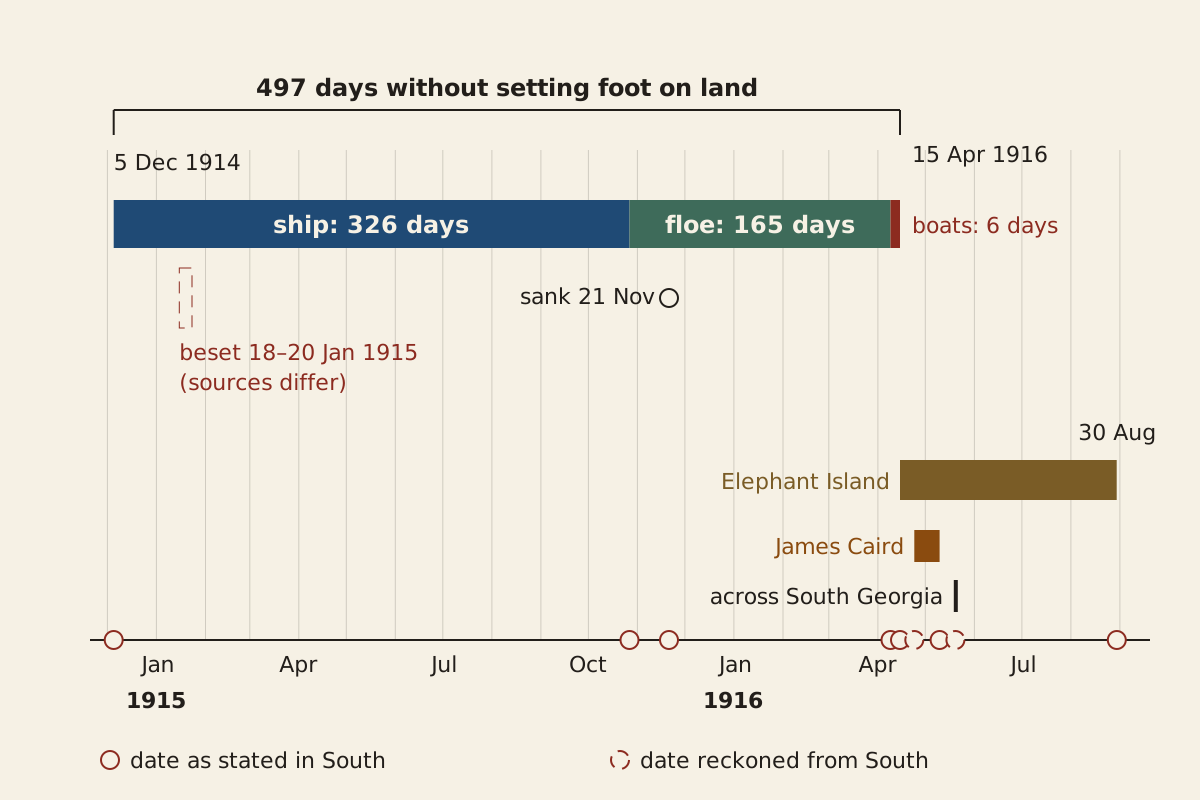
Figure: From the Surviving Record, CC BY 4.0
Full credit line for reuse
"The 497 days of the Endurance party, by phase" by From the Surviving Record, CC BY 4.0. Source: https://fromthesurvivingrecord.com/expeditions/endurance-expedition/ — License: https://creativecommons.org/licenses/by/4.0/
Data: Ernest Shackleton, South (London: Heinemann, 1919), retrieved 2026-11-01, public domain
How long were Shackleton's men without land?
On April 15, 1916, by South's dates, the 28 men of the Endurance were on land again after 497 days. They had last stepped ashore at South Georgia, where Shackleton gave the order to heave anchor at 8.45 a.m. on December 5, 1914, according to Ernest Shackleton's narrative of the expedition, South (1919). In between came nearly eleven months aboard ship, most of them held by the ice, more than five months on the drifting floes and six days in open boats.
The 497 days come to more than 16 months. The book's dates split them into three phases. The Shackleton Experience museum in Athy gives the same 497 days in its timeline, but that timeline is a later compilation, not a second record of the voyage.
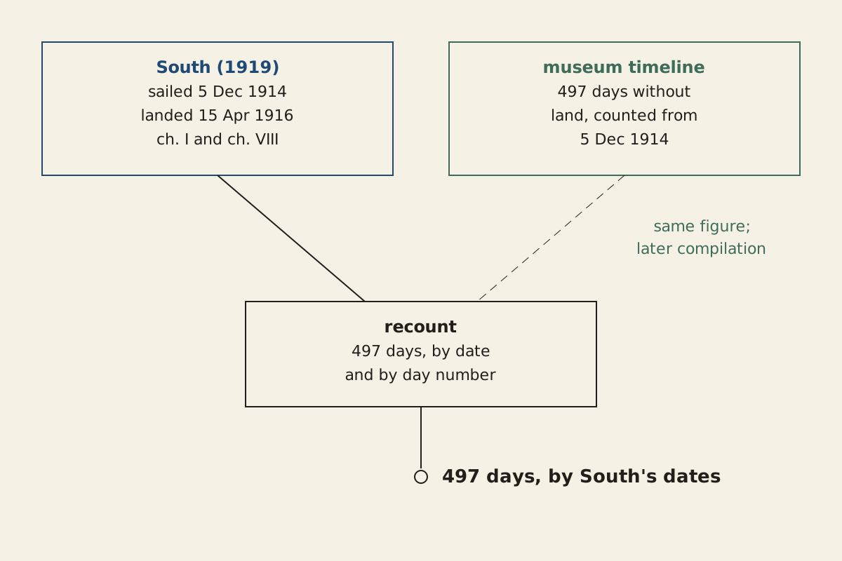
Figure: From the Surviving Record, CC BY 4.0
Full credit line for reuse
"The 497 days by South's dates, the recount and the museum timeline" by From the Surviving Record, CC BY 4.0. Source: https://fromthesurvivingrecord.com/expeditions/endurance-expedition/ — License: https://creativecommons.org/licenses/by/4.0/
Data: Ernest Shackleton, South (London: Heinemann, 1919), retrieved 2026-11-01, public domain; Shackleton Experience, Athy, "Endurance Expedition" timeline, retrieved 2026-11-01, dates cited as facts
| Phase | From | To | Days |
|---|---|---|---|
| Aboard the Endurance, beset from mid-January | December 5, 1914 | October 27, 1915 | 326 |
| On the sea ice, at three camps in turn | October 27, 1915 | April 9, 1916 | 165 |
| In the three boats | April 9, 1916 | April 15, 1916 | 6 |
| Total without land | December 5, 1914 | April 15, 1916 | 497 |
Table: phase dates as given in South, with the day count for each; the full list of dated events, with chapter references, is in the CSV.
Download the table (CSV, endurance-expedition-timeline.csv) (file notes: sources and license) Data: Ernest Shackleton, South (London: Heinemann, 1919), retrieved 2026-11-01, public domain; Shackleton Experience, Athy, "Endurance Expedition" timeline, retrieved 2026-11-01, dates cited as facts
Every interval on this page is counted two ways, by calendar date and by day number, and the two agree. The 28 are the Weddell Sea party only. The expedition also sent a second ship, the Aurora, to the Ross Sea side of the continent, and South counts 56 men in all, three of whom died in the Antarctic. This page follows the 28 of the Endurance, all of whom survived.
The end date has one wrinkle inside South itself. The book's day-by-day account of the boat journey, its list of plates and its whaling appendix all put the landing on April 15, but one sentence after the landing calls the following morning April 15 as well. The museum's 497 days, counted from December 5, also end on April 15.
How did the ice take the Endurance?
The whaling captains at South Georgia had warned Shackleton before he sailed. According to South, they confirmed “the extreme severity of the ice conditions” in that sector and judged that the best time to get into the Weddell Sea would probably be the end of February or early March. Shackleton also knew that the ice had come far north that season. Their predictions led him to take an extra deck-load of coal, in case the ship had to fight her way through.
In mid-January 1915 the Endurance was steaming south-west along an ice coast that Shackleton named the Caird Coast. Shortly before midnight on January 15, she passed a bay at the edge of a great glacier that South calls “an excellent landing-place,” with a flat ice-foot that “looked like a natural quay.” Shackleton named it Glacier Bay. He did not land, because he had “no intention of landing north of Vahsel Bay” unless forced to, and every mile gained to the south meant a mile less of sledging.
On January 16 the ship took shelter behind a stranded iceberg from an east-north-east gale, and she lay there until 7 a.m. on January 18. Then she went on under sail. According to South, the ice “had closed around the ship during the night,” and her position on the morning of the 19th was 76°34′ S, 31°30′ W. A survey on the 20th “showed that the ship was firmly beset.”
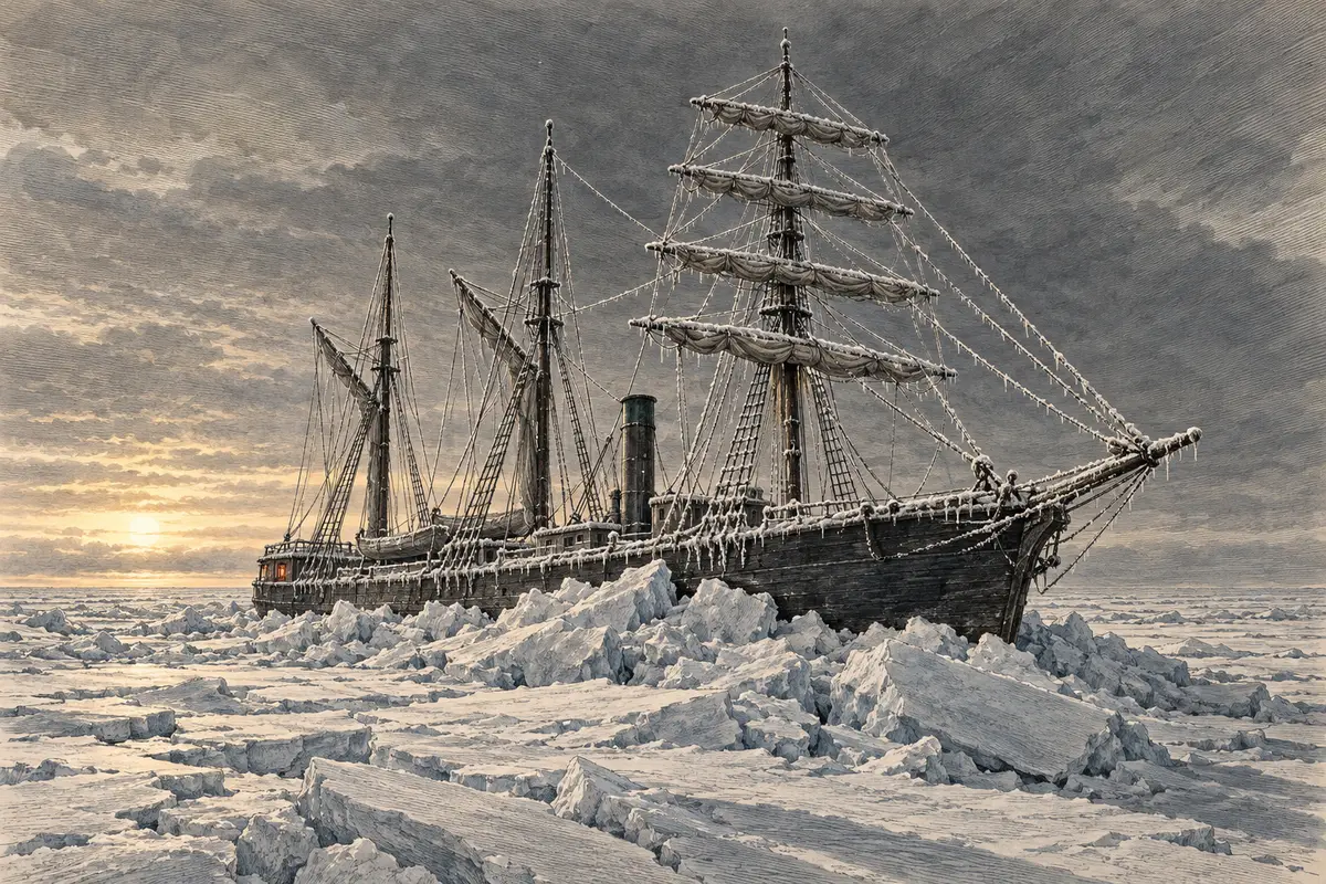
Illustration: From the Surviving Record. Generated schematic image — not a photograph or historical record. © From the Surviving Record, all rights reserved.
The sources disagree on the day. The Shackleton Experience timeline puts the trapping on January 18, and the whaling appendix to South, written by the expedition's biologist Robert Clark, says the ship was held up on January 19. Counted from South Georgia, the ice had the ship after 45 days if the night of the 18th to the 19th is taken, or 46 by the survey of the 20th. The museum's date gives 44.
The crew spent February 14 and most of the 15th cutting at the ice to work the ship toward an open lead ahead. They got her a third of the way. About 400 yards of heavy ice still lay between ship and water, and new ice formed in every opening they made.
According to the book, the drift reached its farthest south on February 22, near the 77th parallel. Around then Shackleton wrote that if he had guessed a month earlier “that the ice would grip us here,” he would have set up the base “at one of the landing-places at the great glacier.” On February 24 the crew stopped keeping ship's routine, and the Endurance became a winter station.
Where did the ice take the ship?
South gives the ship's position at intervals through 1915. Plotted in order, the points run west and then north, away from the Caird Coast toward the Antarctic Peninsula. Between January 19 and March 31, the book says, the drift came to 95 miles in 71 days. Counting those dates gives the same 71.
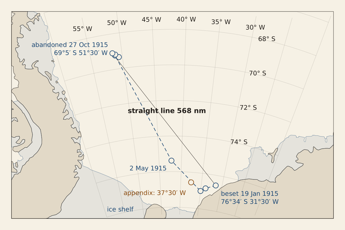
Figure: From the Surviving Record, CC BY 4.0
Full credit line for reuse
"Drift of the Endurance in 1915, from the positions in South" by From the Surviving Record, CC BY 4.0. Source: https://fromthesurvivingrecord.com/expeditions/endurance-expedition/ — License: https://creativecommons.org/licenses/by/4.0/
Data: Ernest Shackleton, South (London: Heinemann, 1919), retrieved 2026-11-01, public domain; Natural Earth 1:50m land and Antarctic ice shelves v5.1.2, retrieved 2026-11-01, public domain
By October 27, in South's narrative, the ship lay at 69°5′ S, 51°30′ W, crushed by the ice. The book puts the straight-line distance from the beset position at 573 miles, and the “total drift through all observed positions” at 1,186 miles. At 5 p.m. that day Shackleton “ordered all hands on to the ice.” The nearest place with food and shelter, by his count, was a hut on Paulet Island 346 miles away, stocked with stores that he had bought in London for an earlier Argentine relief voyage.
South dates the abandonment of the Endurance to October 27, 1915, and the museum timeline gives the same day. The book says the ship had been “locked in the ice” for 281 days, and counting from January 19 gives the same figure.
In his whaling appendix, Clark gives a second beset position, about 76°34′ S, 37°30′ W, six degrees farther west, and he dates the crushing to October 26. The straight line from the chapter's beset position to the October 27 position is 568 nautical miles on the WGS 84 ellipsoid, within 1 percent of the book's 573. From the appendix position the same line is 512. Each distance is worked out two ways, on a sphere and on the ellipsoid, and the two differ by less than half a percent.
By dead reckoning, the chapter's 31°30′ W is the position the book's 573 miles was measured from, and those miles behave like nautical miles, although South does not name the unit. The appendix longitude may be a slip, but nothing in the book says so.
How many applied?
South says Shackleton made the expedition public on January 1, 1914. A few lines earlier, the same preface says “no public announcement was made until January 13, 1914.” The book gives both dates and does not reconcile them.
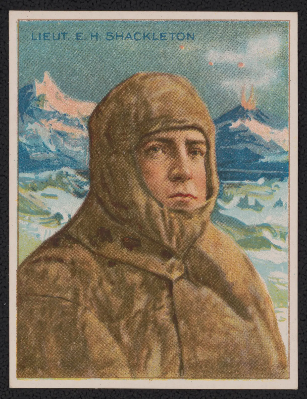
“Lieut. E.H. Shackleton” by American Tobacco Company, Public Domain Mark
Full credit
"Lieut. E.H. Shackleton" by American Tobacco Company — https://commons.wikimedia.org/wiki/File:Lieut._E.H._Shackleton_LCCN2018646108.jpg — Public domain (published in 1910 with no named author, so the EU and UK term for anonymous works, 70 years from publication, ended in 1980; published in the US before 1931)
Next the book reports the response. “I received nearly five thousand applications,” Shackleton wrote, “and out of these were picked fifty-six men.” The 56 were for the whole expedition, both ships, and the Endurance party numbered 28. On those figures, roughly one applicant in 90 was taken.
South does not quote any recruiting advertisement. It ties the applications to the announcement itself, calling them its “first result,” and says nothing about how the applicants heard of it.
What do the stores on record show?
South never prints a full list of the food aboard the Endurance. Around February 24, 1915, orders were given for the after-hold to be cleared “and the stores checked,” but the book does not give the result. The only ship-phase quantity it records is fuel: about 50 tons of coal in the bunkers on October 20, 1915.
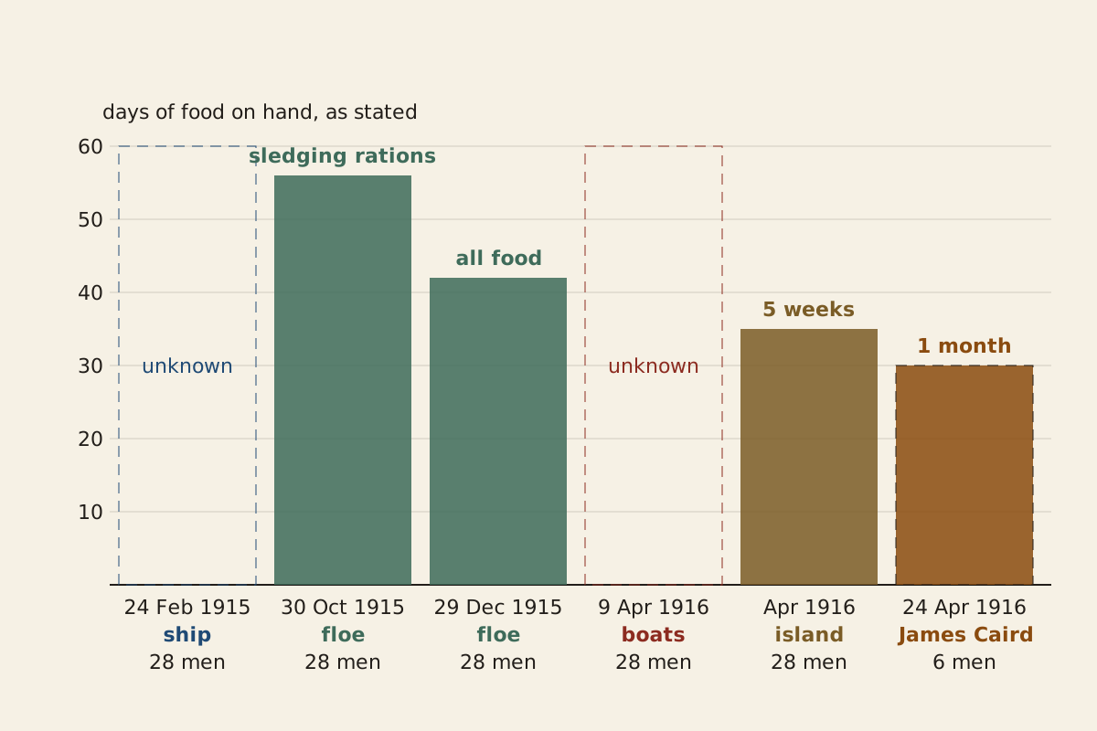
Figure: From the Surviving Record, CC BY 4.0
Full credit line for reuse
"Food on hand at the dates South gives a figure" by From the Surviving Record, CC BY 4.0. Source: https://fromthesurvivingrecord.com/expeditions/endurance-expedition/ — License: https://creativecommons.org/licenses/by/4.0/
Data: Ernest Shackleton, South (London: Heinemann, 1919), retrieved 2026-11-01, public domain
From the abandonment on, the book gives figures at a few dates:
- October 30, 1915: the sledging and boating rations, still untouched, “would provide for twenty-eight men for fifty-six days on full rations.”
- About December 29, 1915: “food for forty-two days,” stated when the second march was given up.
- Early at Patience Camp: about 110 lb of pemmican, counting the dogs' pemmican, and 300 lb of flour beyond the reserve sledging rations, plus 130 lb of dry milk fetched from Ocean Camp.
- A few days after the landing on Elephant Island, April 1916: “full rations for the whole party for a period of five weeks.”
- April 24, 1916, the James Caird: stores to “last six men for one month.”
| Food in the James Caird, April 24, 1916 | Quantity, per South |
|---|---|
| Sledging rations | 3 cases, 300 rations |
| Nut food | 2 cases, 200 rations |
| Biscuits | 2 cases, 600 biscuits |
| Lump sugar | 1 case |
| Trumilk | 30 packets |
| Bovril cubes | 1 tin |
| Cerebos salt | 1 tin |
| Water | 36 gallons, in two casks |
| Ice | 250 lb |
Table: the food items in the list of the boat's stores in South; the CSV adds the paraffin, and the rest of the list is matches, stoves, bedding and instruments.
Download the table (CSV, endurance-expedition-stores-ledger.csv) (file notes: sources and license) Data: Ernest Shackleton, South (London: Heinemann, 1919), retrieved 2026-11-01, public domain
Two cells in this ledger stay empty. One is the food aboard when the ice closed; the other is the food carried in the three boats, where South says only that the stores were shared among them and that some would have to be thrown overboard. They are marked unknown, not estimated. The same rule, count only what the record states, applies to the notes left by the Franklin expedition and to Roald Amundsen's own account of his route to the Pole.
Ocean Camp and Patience Camp
After leaving the ship, the men camped on a floe nearby, at what became Dump Camp. According to South, a march toward land began on October 30 and was given up within days. Each man was allowed two pounds of personal gear for that march. The rest was left in the snow.
The men then moved to a heavy old floe about a mile and a half from the wreck and called it Ocean Camp, their home, the book says, for “nearly two months.” Shackleton decided there to save the sledging rations for the boat journey he expected and to live almost entirely on seals and penguins.
By dead reckoning, the move to Ocean Camp came on November 1. The book gives no date, but its narrative puts the move on the march's third day, counting October 30 as the first.
According to a diary entry printed in South, the Endurance sank on November 21, 1915, and the museum timeline gives the same date. The diarist saw her go down “bows first, her stern raised in the air.”
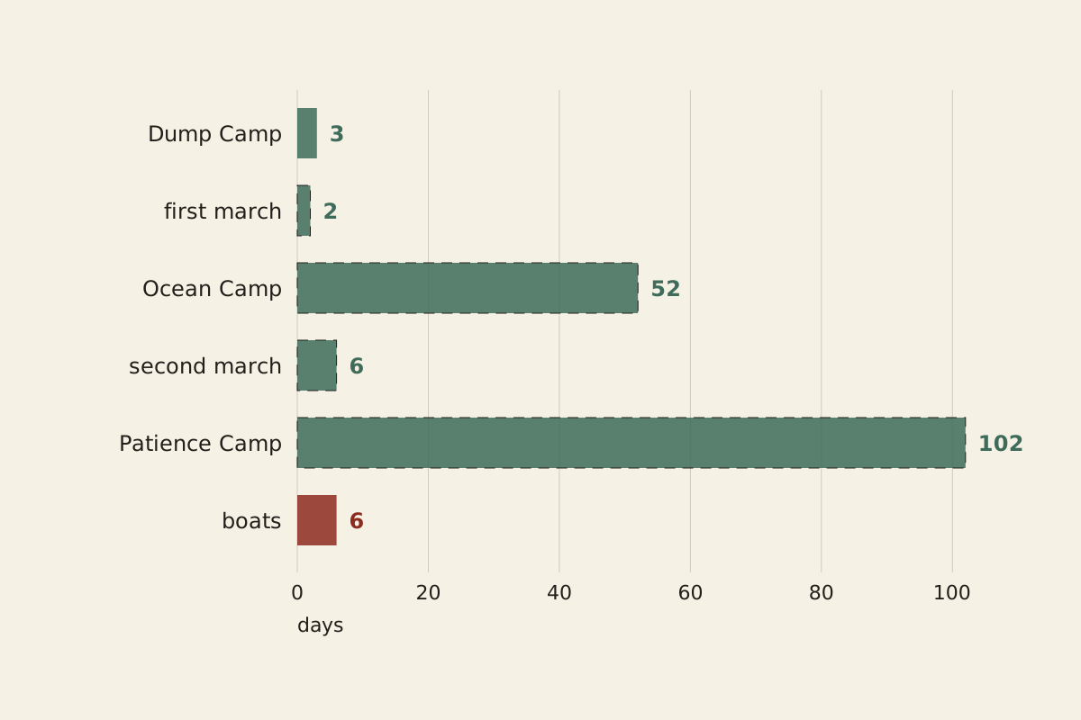
Figure: From the Surviving Record, CC BY 4.0
Full credit line for reuse
"Days at each camp on the ice, October 1915 to April 1916" by From the Surviving Record, CC BY 4.0. Source: https://fromthesurvivingrecord.com/expeditions/endurance-expedition/ — License: https://creativecommons.org/licenses/by/4.0/
Data: Ernest Shackleton, South (London: Heinemann, 1919), retrieved 2026-11-01, public domain
A second march began on December 23. After seven days the party had made seven and a half miles in a straight line. At that rate, Shackleton reckoned, the land to the west was “over three hundred days” away.
With food for forty-two days, they camped again, on the floe that became Patience Camp, and stayed “nearly three and a half months.” The flour would last ten weeks, South says, and the diet ran mainly to seal and penguin. The book reports that “not a single case of scurvy occurred,” though the men felt weak on it.
According to South, the ice opened enough to launch the three boats on Sunday, April 9, 1916. They were the James Caird, the Dudley Docker and the Stancomb Wills, named for the expedition's three main donors.
Why Elephant Island, and why the James Caird?
The boats' goal changed twice in under a week. On the floe, Shackleton chose Deception Island, where the Admiralty sailing directions listed stores for shipwrecked sailors. In the boats, with Deception out of reach and the wind foul for Elephant Island, he set a course for Hope Bay on the mainland. Then the wind shifted fair for Elephant Island, about a hundred miles off, and with the men in worsening shape he ran for it; all three boats landed, by the book's dates, on April 15.
On the island, according to South, there was no chance of any search for them. Port Stanley in the Falklands was 540 miles away, but against the prevailing north-westerly wind.
South Georgia was, in the book's words, “over 800 miles away” but downwind, with whaling stations on its east coast. Shackleton chose South Georgia, with Frank Worsley, the ship's captain, and Crean, McNeish, McCarthy and Vincent as his crew.
Frank Wild stayed behind in command of the island party. The boat would carry stores for one month only, because, Shackleton wrote, if they had not reached South Georgia in that time “we were sure to go under.” To fit the boat for the open ocean, she was given a makeshift deck of canvas laid over case lids and four sledge-runners.
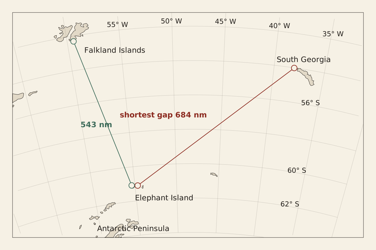
Figure: From the Surviving Record, CC BY 4.0
Full credit line for reuse
"Shortest gaps from Elephant Island to South Georgia and to the Falklands" by From the Surviving Record, CC BY 4.0. Source: https://fromthesurvivingrecord.com/expeditions/endurance-expedition/ — License: https://creativecommons.org/licenses/by/4.0/
Data: Natural Earth 1:50m land v5.1.2, retrieved 2026-11-01, public domain; Ernest Shackleton, South (London: Heinemann, 1919), retrieved 2026-11-01, public domain
Measured on a public-domain coastline, the shortest gap between Elephant Island and South Georgia is about 684 nautical miles, or 787 statute miles. The shortest gap to the Falklands is about 543 nautical miles, measured to the nearest coast; the book's 540 miles are to Port Stanley, a different end point, in a unit it does not name. South gives no coordinates for the launch or the landing, only a latitude of 54°10′47″ S taken at the landing cove on May 13.
By dead reckoning, “over 800 miles” fits a voyage that began and ended at particular beaches and did not run straight. No figure on this page can confirm the distance the boat sailed.
The sources disagree on the boat itself. South calls the James Caird “the 20-ft. boat,” and the museum timeline calls it a 22-foot boat.
How were the 22 on Elephant Island reached?
By dead reckoning, the James Caird left Elephant Island on April 24, 1916. South gives the day only indirectly, as the morning after April 23 and as fourteen days before the crew sighted South Georgia on May 8; the museum timeline gives April 24.
As South tells it, the crossing was a fight to keep the boat afloat. Spray froze on her until she rode “more like a log than a boat,” and the crew threw two frozen sleeping-bags and the spare oars overboard and chipped away the ice by hand. On the night of May 5, Shackleton mistook the crest of a breaking wave for a line of clearing sky; the boat came through it half full of water. By the last days, one of the two water casks had turned brackish from sea water let in at the launching, and the last of it was about a pint.
According to South, they landed in King Haakon Bay on the night of May 10, still 150 miles by sea from the whaling station at Stromness. Early on Friday, May 19, Shackleton, Worsley and Crean set off on foot across the island's mountains; the book names the day only as the Friday after Thursday, May 18. They left McNeish, Vincent and McCarthy under the upturned boat.
The whaling station at Husvik was, by the chart, no more than seventeen geographical miles away in a direct line, but Shackleton wrote that no one had ever gone more than a mile inland on the island. The three carried three days' food, a fifty-foot rope and the carpenter's adze, with screws from the James Caird set in their boot soles for grip.
By dead reckoning, the three walkers reached Stromness on May 20, 1916, since South says their crossing took thirty-six hours from that Friday start; the museum timeline gives May 20.
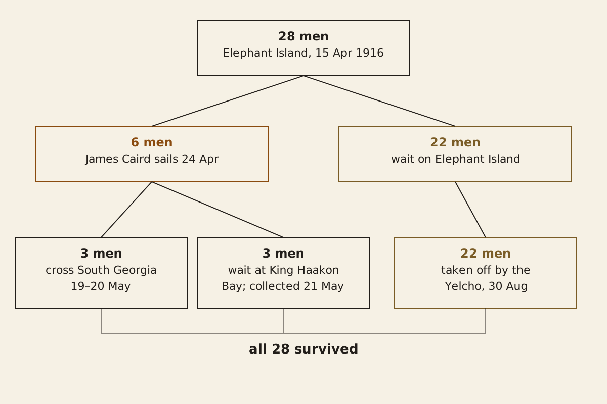
Figure: From the Surviving Record, CC BY 4.0
Full credit line for reuse
"Where the 28 men were after 24 April 1916, and when each group was reached" by From the Surviving Record, CC BY 4.0. Source: https://fromthesurvivingrecord.com/expeditions/endurance-expedition/ — License: https://creativecommons.org/licenses/by/4.0/
Data: Ernest Shackleton, South (London: Heinemann, 1919), retrieved 2026-11-01, public domain; Shackleton Experience, Athy, "Endurance Expedition" timeline, retrieved 2026-11-01, dates cited as facts
A whaling ship collected the other three the next day. The 22 on Elephant Island waited much longer, and South counts four relief attempts in all. The whaler Southern Sky sailed from South Georgia in May, the Uruguayan government's trawler Instituto de Pesca No. 1 from Port Stanley in June, and the schooner Emma in July, and none of the three got through the ice to the island. The fourth, in the small Chilean steamer Yelcho, started south on August 25.
The Yelcho reached Elephant Island on August 30, 1916, South records, and all 22 men were aboard within an hour; the museum timeline gives the same date. The island party had waited 128 days since the James Caird left. On the spit where they waited, the 22 had turned the two remaining boats upside down on low stone walls and hung tent-cloth around them to make a hut. Clark's appendix counts 1,436 gentoo penguins caught on the island between April 15 and August 30.
According to the Endurance22 expedition's own announcement, its team located the wreck of the Endurance on March 5, 2022.
The last good decision
By dead reckoning, the record offers three candidates for the last good decision, and it settles none of them.
The first is Glacier Bay, passed on January 15, 1915. At the time Shackleton knew the ice had come far north that season, the South Georgia whalers had warned him how severe it was in that sector, and he had just seen a sheltered landing-place with a natural quay.
The other course open to him was to land the shore party and stores there and send the ship north before winter. About five weeks later he wrote that he would have landed there had he foreseen the ice, but that was hindsight, written after the ice had closed. Whether a base at Glacier Bay would have changed the outcome cannot be determined from South.
The second is the turn for Elephant Island in April 1916. What could be known then was the men's condition, the wind and the distance, about a hundred miles. The other options were Hope Bay or Deception Island, neither of which the boats reached, so the record shows nothing of how those courses would have gone.
The third is the James Caird itself. South sets out the reasons at the time: winter coming, no search expected and a fair wind for South Georgia, against Port Stanley upwind. Waiting on the island for spring was the other choice. Every man survived the course that was taken, and the book gives no grounds to judge the others.
Still missing:
- How much food the ship carried when the ice closed. South records the order to check the stores in February 1915 but prints no figures.
- How the James Caird's position was worked out between sights on the way to South Georgia. South praises Worsley's navigation but prints no positions for the crossing; the method used between fixes is explained under dead reckoning.
- What the Ross Sea party's record adds. This page follows only the 28 men of the Endurance.
Cite this page
From the Surviving Record. “Shackleton Expedition: His Own Dates Give 497 Days Off Land.” First published 2026-11-01. https://fromthesurvivingrecord.com/expeditions/endurance-expedition/ (accessed add the date you read it).
Sources
- Ernest Shackleton, South: The Story of Shackleton's Last Expedition 1914–1917 (London: William Heinemann, 1919), with appendices by the expedition's scientists. Project Gutenberg eBook #5199. www.gutenberg.org/ebooks/5199 Read: full text.
- Endurance22 Expedition (Falklands Maritime Heritage Trust), "Finding Shackleton's lost ice ship," home page. endurance22.org Read: home page.
- Shackleton Experience (Athy Heritage Company), "Endurance Expedition, 1914–1916: Timeline of Events" and crew list. shackletonexperience.ie/expedition/endurance-expedition Read: full page.
- Natural Earth, 1:50m physical vectors, land polygons and Antarctic ice shelves, version 5.1.2 (public domain). www.naturalearthdata.com/downloads/50m-physical-vectors Read: land polygons for the Weddell Sea, Scotia Sea and Falklands; ice-shelf polygons for the Weddell Sea.
Spotted an error? Write to contact@fromthesurvivingrecord.com (the link fills in this page's title as the subject). Changes are logged in the corrections log and at the foot of the entry; the evidence levels page explains how sources are weighed.
Related entries
-
Expeditions
Franklin Expedition: Two Notes on One Page, 11 Months Apart
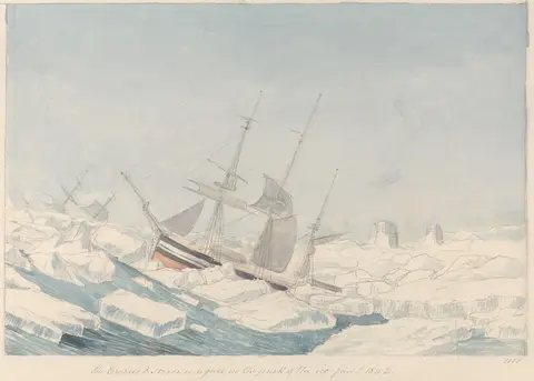
What happened to the Franklin expedition? A sheet found in 1859, as McClintock printed it, holds two notes: “All well” in 1847, ships deserted in April 1848.
Picture credit
"The Erebus & Terror in a Gale in the Pack of the Ice" by Charles Hamilton Smith — https://commons.wikimedia.org/wiki/File:Charles_Hamilton_Smith_-_The_Erebus_%5E_Terror_in_a_Gale_in_the_Pack_of_the_Ice_-_B1978.43.1820(55)_-_Yale_Center_for_British_Art.jpg — CC0 1.0 (https://creativecommons.org/publicdomain/zero/1.0/)
-
Expeditions
Roald Amundsen: First at the Pole, by Both Leaders' Records
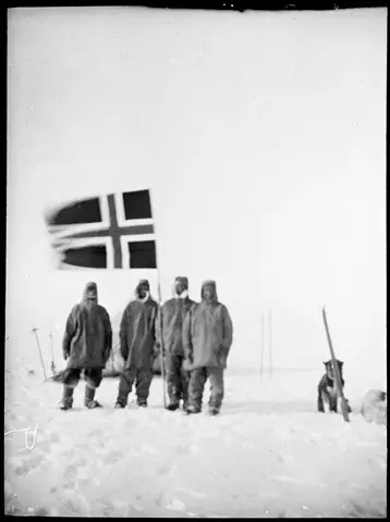
Roald Amundsen reached the South Pole on December 14, 1911, by his own book; Scott reached it on January 17, 1912, by his journal. Dates, latitudes, routes.
Picture credit
"Oscar Wisting, Olav Bjaaland, Sverre Hassel og Roald Amundsen på Sydpolen" by Helmer Hanssen / National Library of Norway — https://commons.wikimedia.org/wiki/File:Oscar_Wisting,_Olav_Bjaaland,_Sverre_Hassel_og_Roald_Amundsen_p%C3%A5_Sydpolen_14.12.1911_(7635391194).jpg — CC BY 2.0 (https://creativecommons.org/licenses/by/2.0/)