Franklin Expedition: Two Notes on One Page, 11 Months Apart
Published Last substantive revision
How to read this page: each point is marked as a cross-checked fix, a single record (“according to”), or inference (“by dead reckoning”).
TL;DR: A single printed form found on King William Island in 1859 carries two notes from Franklin's lost expedition, as transcribed by Francis McClintock: one dated May 28, 1847, reporting “All well,” and one added around its margin on April 25, 1848. The second note says the ships had been deserted on April 22, 1848, that Sir John Franklin had died on June 11, 1847, and that 105 men had landed.
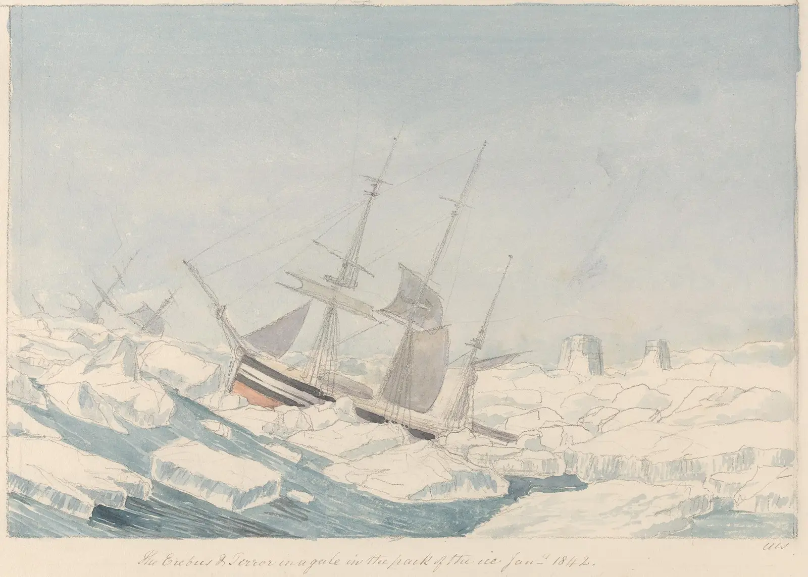
"The Erebus & Terror in a Gale in the Pack of the Ice" by Charles Hamilton Smith — https://commons.wikimedia.org/wiki/File:Charles_Hamilton_Smith_-_The_Erebus_%5E_Terror_in_a_Gale_in_the_Pack_of_the_Ice_-_B1978.43.1820(55)_-_Yale_Center_for_British_Art.jpg — CC0 1.0 (https://creativecommons.org/publicdomain/zero/1.0/)
What does the Victory Point note say?
In May 1859, searchers on King William Island found one sheet of paper carrying two notes, written 11 months apart. Lieutenant W. R. Hobson's sledge party found it at a cairn at Point Victory, on the island's northwest coast. Francis McClintock, who led the search in the yacht Fox, printed both notes in The Voyage of the ‘Fox’ in the Arctic Seas that same year.
Hartwig's 1869 account gives the day of the find as May 6. Hobson took the original away. A copy went back into the cairn, which he had rebuilt stone by stone, and McClintock added a record of his own when he reached Point Victory on June 2.
The sheet was never meant as a letter: according to McClintock, it was one of the printed forms supplied to discovery ships to be sealed in bottles and thrown overboard, so that a finder could report where the current had carried it. Blanks were left for the date and position, and the request to send it to the Secretary of the Admiralty was printed “in six different languages.”
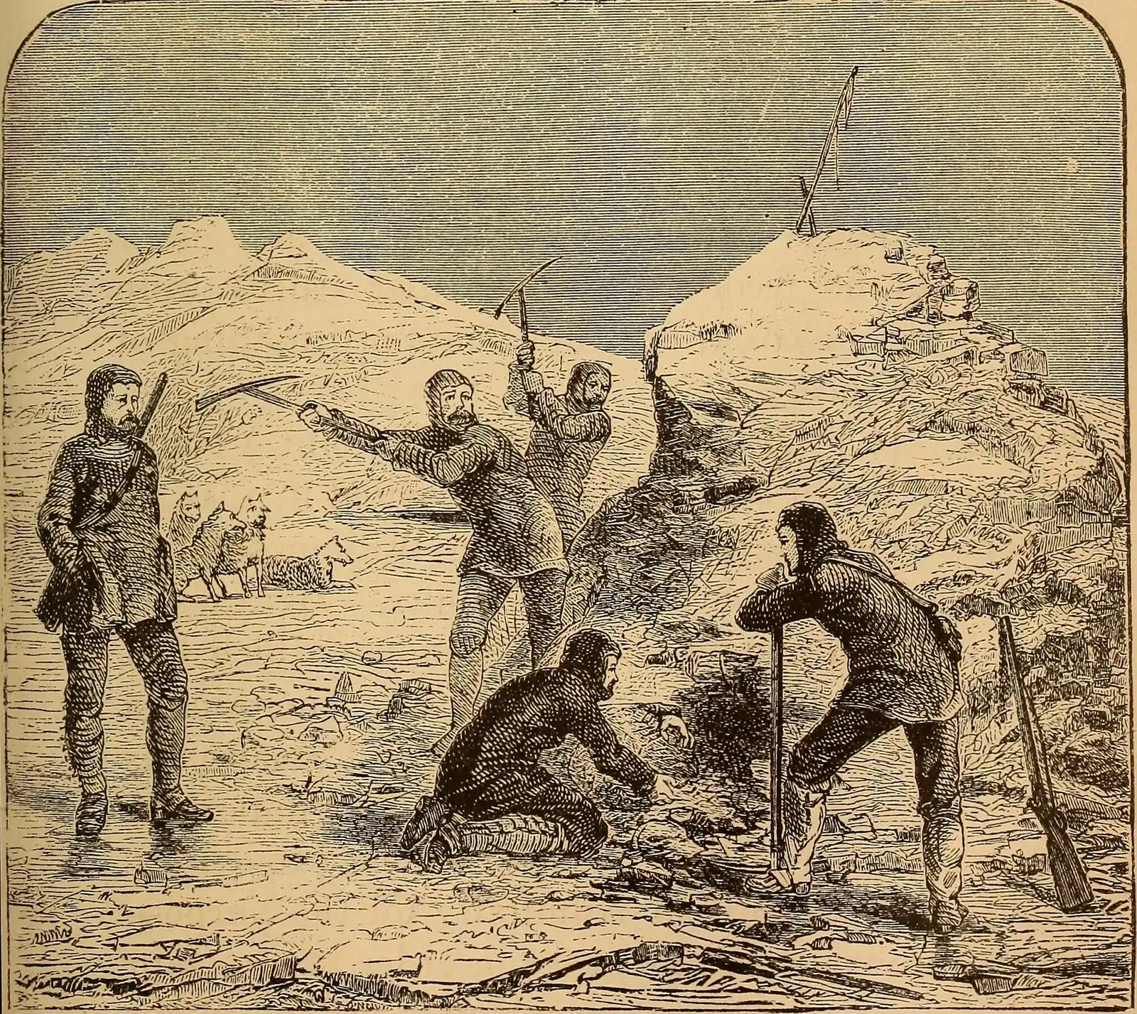
“Discovery of Franklin’s cairn” by Unknown illustrator, in The Frozen Zone and Its…, Public domain
Full credit
"Discovery of Franklin’s cairn" by Unknown illustrator, in The Frozen Zone and Its Explorers (Hartford, 1874) — https://commons.wikimedia.org/wiki/File:Discovery_of_John_Franklin%27s_cairn.jpg — Public domain (US: published in Hartford, Connecticut, in 1874, before 1931; EU: the illustrator is not named, and the term for an anonymous work, 70 years from publication, ended long ago)
Here is the record as McClintock printed it, line by line, with his spelling and punctuation. The hands are his judgments, not signatures checked against other papers.
| Note | Line | Text, as printed by McClintock | Hand, per McClintock |
|---|---|---|---|
| 1847 | 1 | 28 of May, 1847. | Gore, apparently; the day added later by Fitzjames |
| 1847 | 2 | H. M. ships ‘Erebus’ and ‘Terror’ wintered in the ice in lat. 70° 05′ N., long. 98° 23′ W. | Gore, apparently |
| 1847 | 3 | Having wintered in 1846-7 at Beechey Island, in lat. 74° 43′ 28″ N., long. 91° 39′ 15″ W., after having ascended Wellington Channel to lat. 77°, and returned by the west side of Cornwallis Island. | Gore, apparently |
| 1847 | 4 | Sir John Franklin commanding the expedition. | Gore, apparently |
| 1847 | 5 | All well. | Gore, apparently |
| 1847 | 6 | Party consisting of 2 officers and 6 men left the ships on Monday 24th May, 1847. | Gore, apparently |
| 1847 | 7 | Gm. Gore, Lieut. | Gore, apparently |
| 1847 | 8 | Chas. F. Des Vœux, Mate. | Gore, apparently |
| 1848 | 9 | April 25, 1848.—H. M. ships ‘Terror’ and ‘Erebus’ were deserted on the 22nd April, 5 leagues N.N.W. of this, having been beset since 12th September, 1846. | Fitzjames, evidently |
| 1848 | 10 | The officers and crews, consisting of 105 souls, under the command of Captain F. R. M. Crozier, landed here in lat. 69° 37′ 42″ N., long. 98° 41′ W. | Fitzjames, evidently |
| 1848 | 11 | Sir John Franklin died on the 11th June, 1847; and the total loss by deaths in the expedition has been to this date 9 officers and 15 men. | Fitzjames, evidently |
| 1848 | 12 | (Signed) F. R. M. Crozier, Captain and Senior Officer. | Fitzjames, evidently |
| 1848 | 13 | (Signed) James Fitzjames, Captain H. M. S. Erebus. | Fitzjames, evidently |
| 1848 | 14 | and start (on) to-morrow, 26th, for Back's Fish River. | Crozier |
| 1848 | 15 | late (one word quoted from a further margin note) | not stated |
Table: transcribed from McClintock (1859), pages 283 to 287; the hand column gives his attributions, with his own hedges.
Download the table (CSV, franklin-expedition-note.csv) (file notes: sources and license) Data: Francis L. McClintock, The Voyage of the ‘Fox’ in the Arctic Seas (London: John Murray, 1859), retrieved 2026-11-01, public domain
Who wrote which line?
According to McClintock, the 1847 text was written “apparently by Lieutenant Gore,” and the margin “evidently” by Captain James Fitzjames, except the last line about the march, which Captain Francis Crozier added. McClintock adds a detail that changes how the first date reads. The forms were filled in aboard before the sledge party left, he writes, with the day left blank, and Fitzjames wrote in “28th” only when the paper was opened again in 1848. McClintock judged this from the colour of the ink.
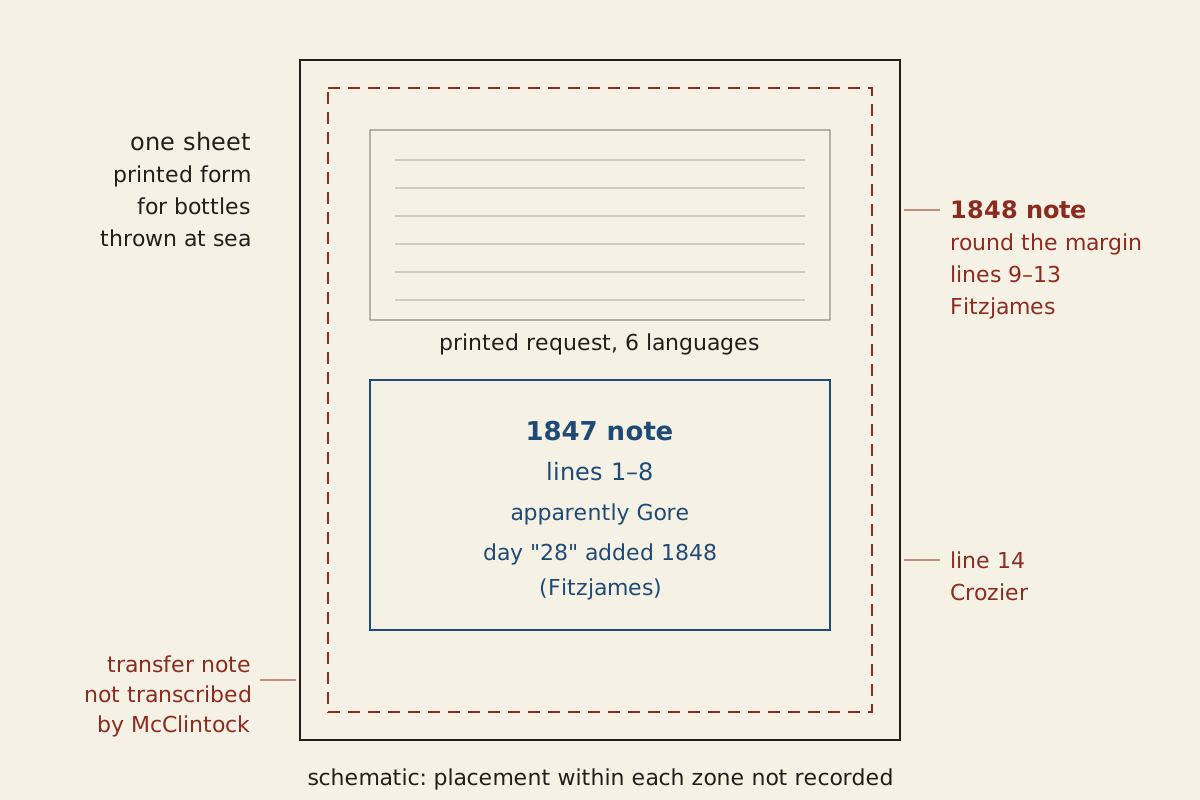
Figure: From the Surviving Record, CC BY 4.0
Full credit line for reuse
"Which part of the Victory Point record each note occupies" by From the Surviving Record, CC BY 4.0. Source: https://fromthesurvivingrecord.com/expeditions/franklin-expedition/ — License: https://creativecommons.org/licenses/by/4.0/
Data: Francis L. McClintock, The Voyage of the ‘Fox’ in the Arctic Seas (London: John Murray, 1859), retrieved 2026-11-01, public domain
By dead reckoning, then, “All well” describes the ships as they stood no later than the day Gore's party set out, Monday, May 24, 1847, at least four days before the date on the form. The weekday checks out. By two separate calendar calculations, May 24, 1847, falls on a Monday.
The paper had also moved. A further margin note, which McClintock summarizes but does not print, says the record was brought from a spot four miles to the north, where “the late Commander Gore” had left it. McClintock read a whole fact into that one word: “he too, within the twelvemonth, had passed away.”
McClintock judged that no record at all had been planned for after the ships were abandoned. He called the two notes “perfect models of official brevity,” adding that “no log-book could be more provokingly laconic.” Hobson found a second Gore record on the south side of Back Bay. It added no new information, McClintock wrote, and repeated the same mistake about Beechey Island.
Where were the ships?
The 1847 note gives two positions, and, according to McClintock, both of Gore's records date the first winter wrong. “Having wintered in 1846-7 at Beechey Island,” Gore's text says. McClintock points out the error at once: the correct dates “should have been 1845-6,” and the date at the top and the bottom of the record proves it. He put it down to how little the papers seemed to matter when they were filled in: “So obvious a mistake would hardly have been made had any importance been attached to these documents.”
The 2018 lead study's outline of the voyage agrees, putting the Beechey Island winter before the ships sailed south in the summer of 1846. That outline cites later histories of the expedition rather than a separate record, so the correction rests on McClintock's reading.
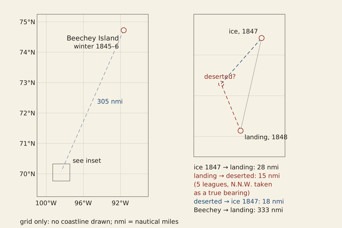
Figure: From the Surviving Record, CC BY 4.0
Full credit line for reuse
"Positions written in the Victory Point record, with distances" by From the Surviving Record, CC BY 4.0. Source: https://fromthesurvivingrecord.com/expeditions/franklin-expedition/ — License: https://creativecommons.org/licenses/by/4.0/
Data: Francis L. McClintock, The Voyage of the ‘Fox’ in the Arctic Seas (London: John Murray, 1859), retrieved 2026-11-01, public domain; Treena Swanston et al., “Franklin expedition lead exposure: New insights from high resolution confocal x-ray fluorescence imaging of skeletal microstructure,” PLOS ONE 13(8): e0202983 (2018), retrieved 2026-11-01, CC BY 4.0
The positions in the record can be measured against each other, and the ships' 1847 position in the ice lies about 305 nautical miles from Beechey Island and about 28 nautical miles from the 1848 landing place. A nautical mile here is 1,852 meters. Each distance is computed two ways, on a sphere and on an ellipsoid, and the two agree to within half a percent.
The landing place, where the second note was written, was the site of Sir James Ross's pillar, according to McClintock. The 1848 note gives no coordinates for where the ships were left, only “5 leagues N.N.W. of this.” The 2018 lead study reads that as 15 nautical miles NNW of Victory Point.
By dead reckoning, taking N.N.W. as a true bearing, which the note does not say, the ships were deserted about 18 nautical miles from where they had been held in May 1847. On those assumptions, the two ships moved with the ice between the notes, but not far.
What happened between the two notes?
The second note covers eleven months in three sentences. The ships, it says, had been beset, held fast in the ice, since September 12, 1846. They were deserted on April 22, 1848, 588 days later, or more than 19 months. Franklin had died on June 11, 1847, only 14 days after the date on Gore's form.
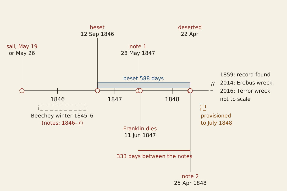
Figure: From the Surviving Record, CC BY 4.0
Full credit line for reuse
"Franklin expedition timeline, 1845 to 1848, from the two notes" by From the Surviving Record, CC BY 4.0. Source: https://fromthesurvivingrecord.com/expeditions/franklin-expedition/ — License: https://creativecommons.org/licenses/by/4.0/
Data: Francis L. McClintock, The Voyage of the ‘Fox’ in the Arctic Seas (London: John Murray, 1859), retrieved 2026-11-01, public domain; Treena Swanston et al., “Franklin expedition lead exposure: New insights from high resolution confocal x-ray fluorescence imaging of skeletal microstructure,” PLOS ONE 13(8): e0202983 (2018), retrieved 2026-11-01, CC BY 4.0; G. Hartwig, The Polar World (New York: Harper & Brothers, 1869), retrieved 2026-11-01, public domain
The two notes are 333 days apart, from May 28, 1847, to April 25, 1848, and each interval on this page is computed twice, from calendar dates and from Julian day numbers, with identical results.
How the expedition began is less certain. McClintock says only that Franklin sailed in 1845, and that the last news came in July 1845 from whalers in Melville Bay. The sources disagree on the day of sailing: the 2018 lead study gives May 19, 1845, and Hartwig's 1869 account gives May 26.
On paper, the stores were nearly at an end. McClintock wrote that the Erebus and Terror “were only provisioned up to July, 1848.” By that measure, the crews deserted the ships with about three months of planned provisioning left, at most 100 days to the end of July. A ship held fast for a long season is also the problem at the center of the Endurance expedition, on the other side of the world.
How many men left the ships?
By the second note's count, 105 men landed under Crozier, and 9 officers and 15 men had died, 24 in all. That makes 129. McClintock first set those figures against the 138 men generally thought to have sailed. He worked out that 114 should have been left, and called 9 men “unaccounted for.”
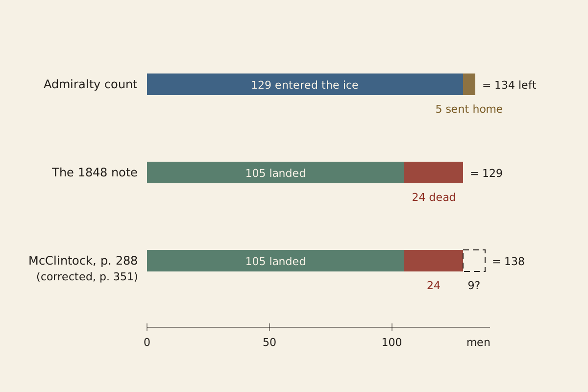
Figure: From the Surviving Record, CC BY 4.0
Full credit line for reuse
"How the 1848 note’s numbers add up against the Admiralty count" by From the Surviving Record, CC BY 4.0. Source: https://fromthesurvivingrecord.com/expeditions/franklin-expedition/ — License: https://creativecommons.org/licenses/by/4.0/
Data: Francis L. McClintock, The Voyage of the ‘Fox’ in the Arctic Seas (London: John Murray, 1859), retrieved 2026-11-01, public domain
He corrected himself in the same book. In its conclusion, citing the Admiralty, McClintock wrote that 134 men left the United Kingdom and that 5 came home again, one in HMS Rattler and four in the transport Barretto Junior, so that 129 entered the ice: “the exact number mentioned in the record.” The 2018 lead study gives 134 and 129 as well, though its abstract says 128.
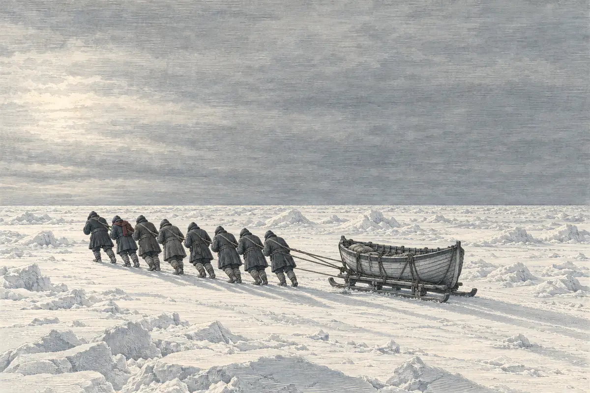
Illustration: From the Surviving Record. Generated schematic image — not a photograph or historical record. © From the Surviving Record, all rights reserved.
The note says where the 105 were headed: “Back's Fish River.” McClintock describes this as a retreat “up the Back or Great Fish River” toward the Hudson Bay territories.
The note does not list what they carried. The ground around the cairn suggests what they gave up. McClintock lists four heavy sets of boat's cooking stoves, pickaxes, shovels, a small case of medicines and a heap of clothing four feet high, things the crews could not carry farther even after a three days' march from the ships, as he put it. By dead reckoning, the loads were already more than the men chose to carry three days out, though the record does not say whether weakness, weather or a change of plan was the reason.
What killed the crews?
The note records deaths but no causes, and the causes are still argued, with lead poisoning among the most discussed. Lead is a heavy metal, and the solder that sealed tinned food was one suggested source. A 2018 study by Treena Swanston and colleagues in PLOS ONE tested the idea with X-ray imaging of bone and tooth samples from crew members. It compared them with Royal Navy sailors buried in Antigua between 1793 and 1822.
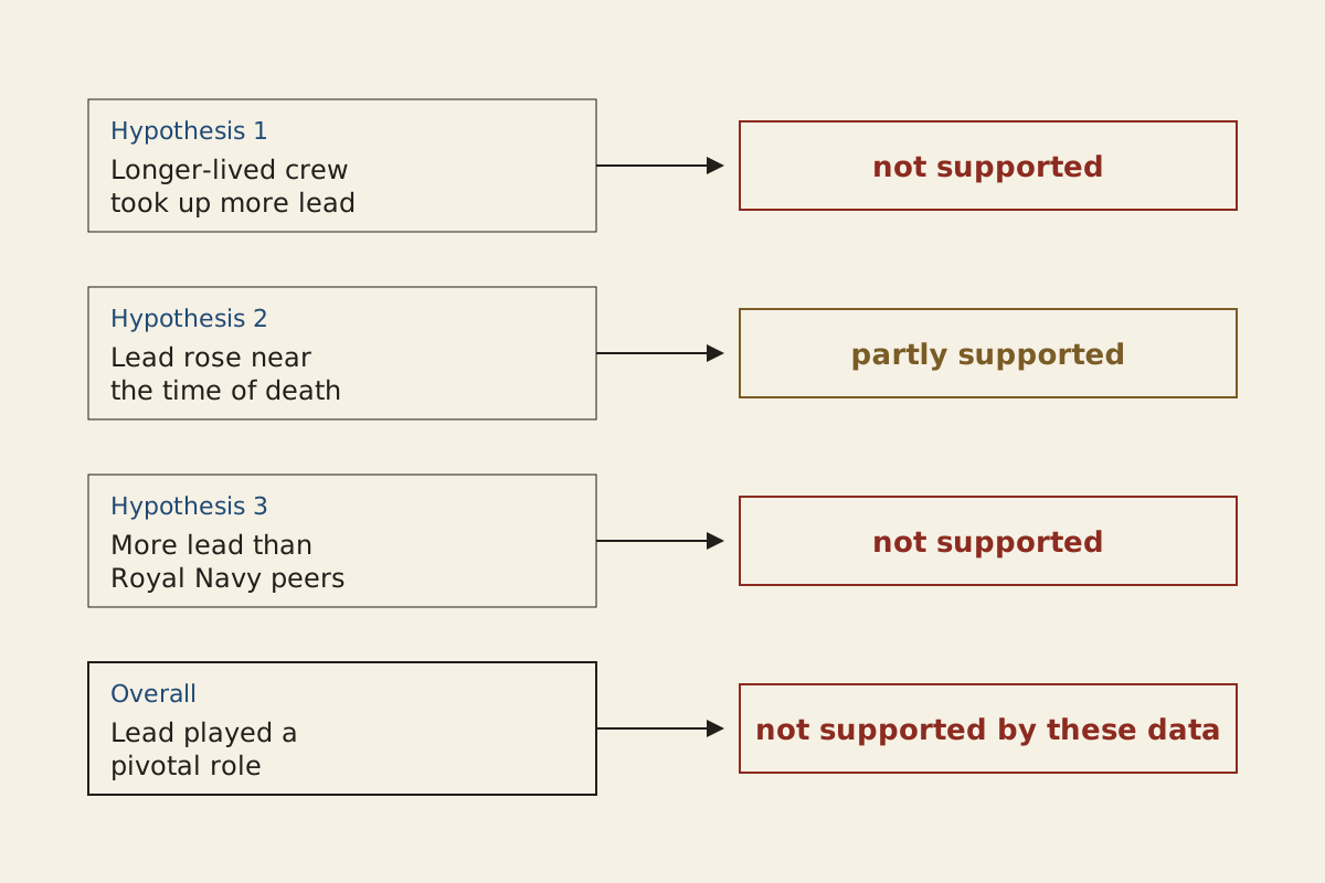
Figure: From the Surviving Record, CC BY 4.0
Full credit line for reuse
"Results of the 2018 Franklin lead study, by hypothesis" by From the Surviving Record, CC BY 4.0. Source: https://fromthesurvivingrecord.com/expeditions/franklin-expedition/ — License: https://creativecommons.org/licenses/by/4.0/
Data: Treena Swanston et al., “Franklin expedition lead exposure: New insights from high resolution confocal x-ray fluorescence imaging of skeletal microstructure,” PLOS ONE 13(8): e0202983 (2018), retrieved 2026-11-01, CC BY 4.0
| Hypothesis tested in the 2018 study | Result, per the authors |
|---|---|
| Men who lived longer took up more lead in their bones | Not supported: the patterns at the two burial sites were similar |
| Bone and tooth formed near death show markedly raised lead | Partly supported: lead was present, but not markedly raised for most |
| The crew had more lead than other Royal Navy sailors of the period | Not supported: not unusually high for the time |
Table: summarized from the abstract and conclusions of Swanston et al. (2018).
Download the table (CSV, franklin-expedition-lead-study.csv) (file notes: sources and license) Data: Treena Swanston et al., “Franklin expedition lead exposure: New insights from high resolution confocal x-ray fluorescence imaging of skeletal microstructure,” PLOS ONE 13(8): e0202983 (2018), retrieved 2026-11-01, CC BY 4.0
According to the authors, their results “do not support the conclusion that Pb played a pivotal role in the loss of Franklin and his crew.” Pb is the chemical symbol for lead. They also note a limit: their method shows where lead sits in the bone, not how much there is.
The same paper reviews other proposals, among them starvation, scurvy, zinc deficiency and a disease linked to tuberculosis, and says the main causes of death remain “the subject of continuing debate.” The role of lead has also been questioned in a 2015 re-analysis by K. Millar, A. W. Bowman and W. Battersby in Polar Record. This page has read only the 2018 study in full, so it does not rank the causes.
Where are the ships now?
The second note says where the ships were left, but not what became of them. According to the 2018 study, the wreck of Erebus was found in 2014 and the wreck of Terror in 2016. Parks Canada now describes the two wrecks as a national historic site, managed jointly with Inuit, and as of November 2026 it lists the site as not yet open to visitors (Parks Canada).
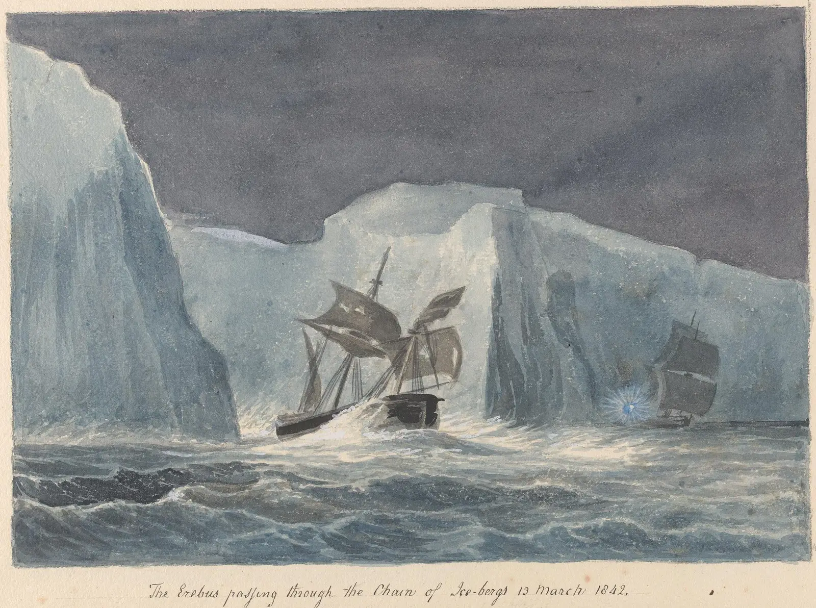
"The Erebus Passing Through the Chain of Icebergs" by Charles Hamilton Smith — https://commons.wikimedia.org/wiki/File:Charles_Hamilton_Smith_-_The_Erebus_Passing_Through_the_Chain_of_Icebergs_-_B1978.43.1820(54)_-_Yale_Center_for_British_Art.jpg — CC0 1.0 (https://creativecommons.org/publicdomain/zero/1.0/)
Before Franklin's voyage, the same two ships had sailed south. Hartwig's account describes Erebus and Terror in the Antarctic in 1841 and 1842 under James Clark Ross, with Crozier commanding Terror. It calls them “well-tried in the Antarctic Seas” when Franklin took them north, and says Ross went farther toward the pole than any navigator before him. The route Roald Amundsen later took to the South Pole itself is set out in another entry.
The last good decision
By dead reckoning, the first candidate for the last good decision is the course the second note records: desert the ships, as was done on April 22, 1848, and start on the 26th for Back's Fish River. What the officers could know is partly on the page. The ships had been held for 588 days, 24 men were dead, and McClintock says the stores ran only to July 1848.
McClintock saw little choice in it. He called the march “a last bold struggle for life,” chosen rather than to “perish without effort on board their ships.” The alternatives open on paper were to stay with the ships for another season or to march in another direction. No log, journal or list of stores from 1848 is on file, so the state of the men and the food that day is unknown.
A second candidate is the 1846 choice of route into the ice off King William Island. McClintock later wrote that the result might have been different had Franklin known of a ship channel sheltered by the island. That is hindsight: as McClintock puts it, Franklin did not know the channel existed. Information the officers did not have cannot make a decision point.
On the surviving record, neither candidate can be judged. The only written trace of the choice is one paper, filled in on an April day in the Arctic with ink that, McClintock notes, had to be thawed first.
Still missing:
- Where the logs and journals went. McClintock's search turned up the two Gore records and no journal, and no source read for this page reports one found since.
- What killed most of the 129 who entered the ice, by McClintock's count. Lead, scurvy, starvation and disease have all been proposed, and the one study read here in full tested only lead.
- Why a crew leaves its ship. A ship found afloat with no one aboard raises the same question from the other side: Mary Celeste: Conan Doyle's 1884 Story Called Her 'Marie'.
Cite this page
From the Surviving Record. “Franklin Expedition: Two Notes on One Page, 11 Months Apart.” First published 2026-11-01. https://fromthesurvivingrecord.com/expeditions/franklin-expedition/ (accessed add the date you read it).
Sources
- Francis L. McClintock, The Voyage of the ‘Fox’ in the Arctic Seas: A Narrative of the Discovery of the Fate of Sir John Franklin and His Companions (London: John Murray, 1859), pp. 283–288, 301–305, 341, 350–351. archive.org/details/voyageoffoxinarc00mcli_0 Read: chapters 15 to 17 and the conclusion; the note transcription on pages 283–286 checked against the page images.
- Treena Swanston, Tamara L. Varney, Madalena Kozachuk et al., “Franklin expedition lead exposure: New insights from high resolution confocal x-ray fluorescence imaging of skeletal microstructure,” PLOS ONE 13, no. 8 (2018): e0202983. doi.org/10.1371/journal.pone.0202983 Read: full text.
- G. Hartwig, The Polar World: A Popular Description of Man and Nature in the Arctic and Antarctic Regions of the Globe (New York: Harper & Brothers, 1869), chs. XXXIII and XXXVIII. www.gutenberg.org/ebooks/61398 Read: chapters XXXIII and XXXVIII.
- Parks Canada, “Wrecks of HMS Erebus and HMS Terror National Historic Site.” parks.canada.ca/lhn-nhs/nu/epaveswrecks Read: paraphrased only (non-commercial terms).
- K. Millar, A. W. Bowman and W. Battersby, “A re-analysis of the supposed role of lead poisoning in Sir John Franklin’s last expedition, 1845–1848,” Polar Record 51, no. 3 (2015): 224–238. doi.org/10.1017/S0032247413000867 Read: bibliographic record only.
Spotted an error? Write to contact@fromthesurvivingrecord.com (the link fills in this page's title as the subject). Changes are logged in the corrections log and at the foot of the entry; the evidence levels page explains how sources are weighed.
Related entries
-
Expeditions
Shackleton Expedition: His Own Dates Give 497 Days Off Land
By the dates in Shackleton's South, the 28 men of the Endurance went 497 days without land. Each phase dated and counted, with the partial stores ledger as CSV.
Picture credit
Illustration: From the Surviving Record. Generated schematic image — not a photograph or historical record. © From the Surviving Record, all rights reserved.
-
Expeditions
Roald Amundsen: First at the Pole, by Both Leaders' Records
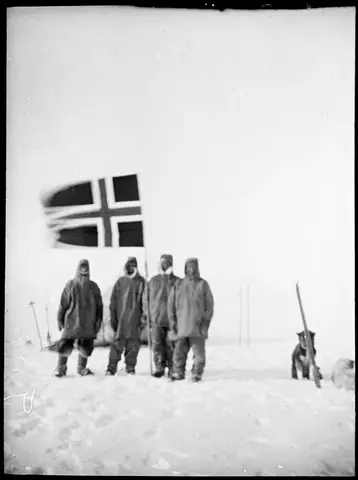
Roald Amundsen reached the South Pole on December 14, 1911, by his own book; Scott reached it on January 17, 1912, by his journal. Dates, latitudes, routes.
Picture credit
"Oscar Wisting, Olav Bjaaland, Sverre Hassel og Roald Amundsen på Sydpolen" by Helmer Hanssen / National Library of Norway — https://commons.wikimedia.org/wiki/File:Oscar_Wisting,_Olav_Bjaaland,_Sverre_Hassel_og_Roald_Amundsen_p%C3%A5_Sydpolen_14.12.1911_(7635391194).jpg — CC BY 2.0 (https://creativecommons.org/licenses/by/2.0/)